

Augel GmbH expands portfolio
New business division for GIS and surveying service providers
WEIBERN, 06.09.2024. Augel GmbH from Weibern, in the district of Ahrweiler, has gained a new mainstay with the specialist areas of GIS and surveying services. The company from Rhineland-Palatinate, which is well established in pipeline and petrol station construction as well as pipeline construction, now also covers the areas of drone flights and surveying with its 3D Solutions division. Augel offers state-of-the-art equipment and promises fast scans and recordings characterised by maximum accuracy. According to the construction service provider, it offers a comprehensive portfolio of services from a single source with customised solutions for customers. In addition, prompt authorisations – even for aerial surveys within populated areas - are always possible.
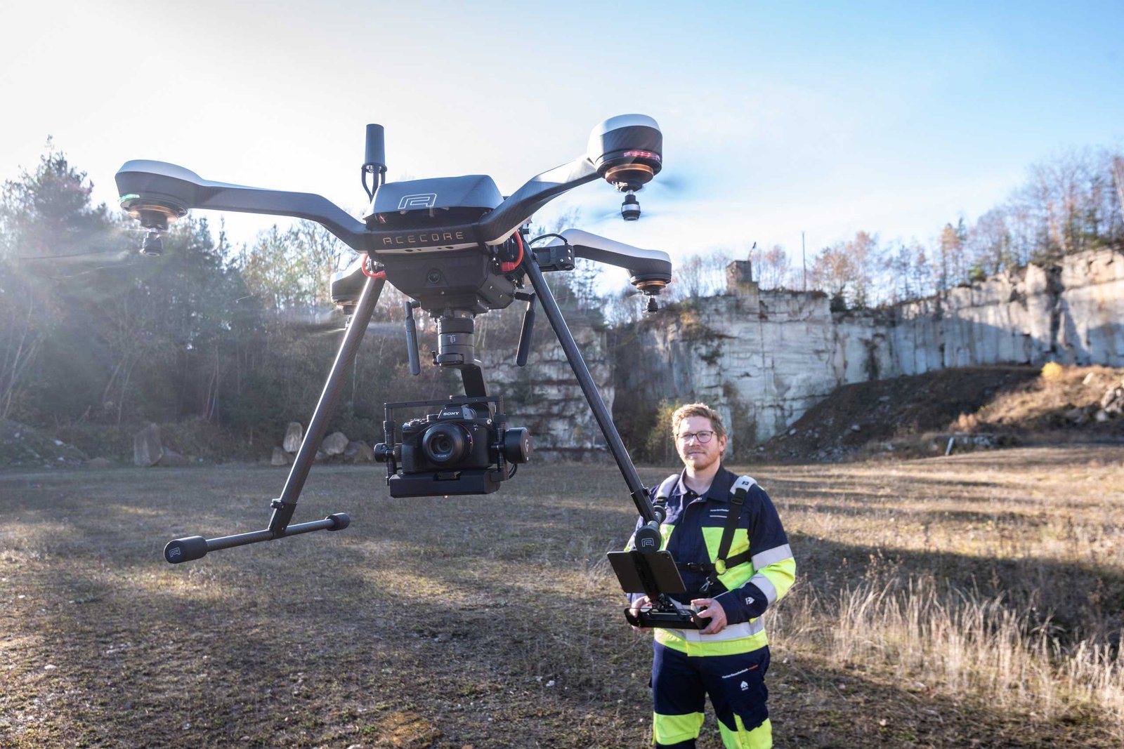
'In areas with fewer than 200 inhabitants per square kilometre, we can start flying almost immediately', reveals Florian Reuschenbach. The surveying engineer has been responsible for the new 3D Solutions department at Augel GmbH since October 2020. 'But even in densely populated regions, we are usually able to obtain a permit from the state aviation authority within a week. We can also guarantee a speedy take-off behind the town sign', adds the GIS expert.
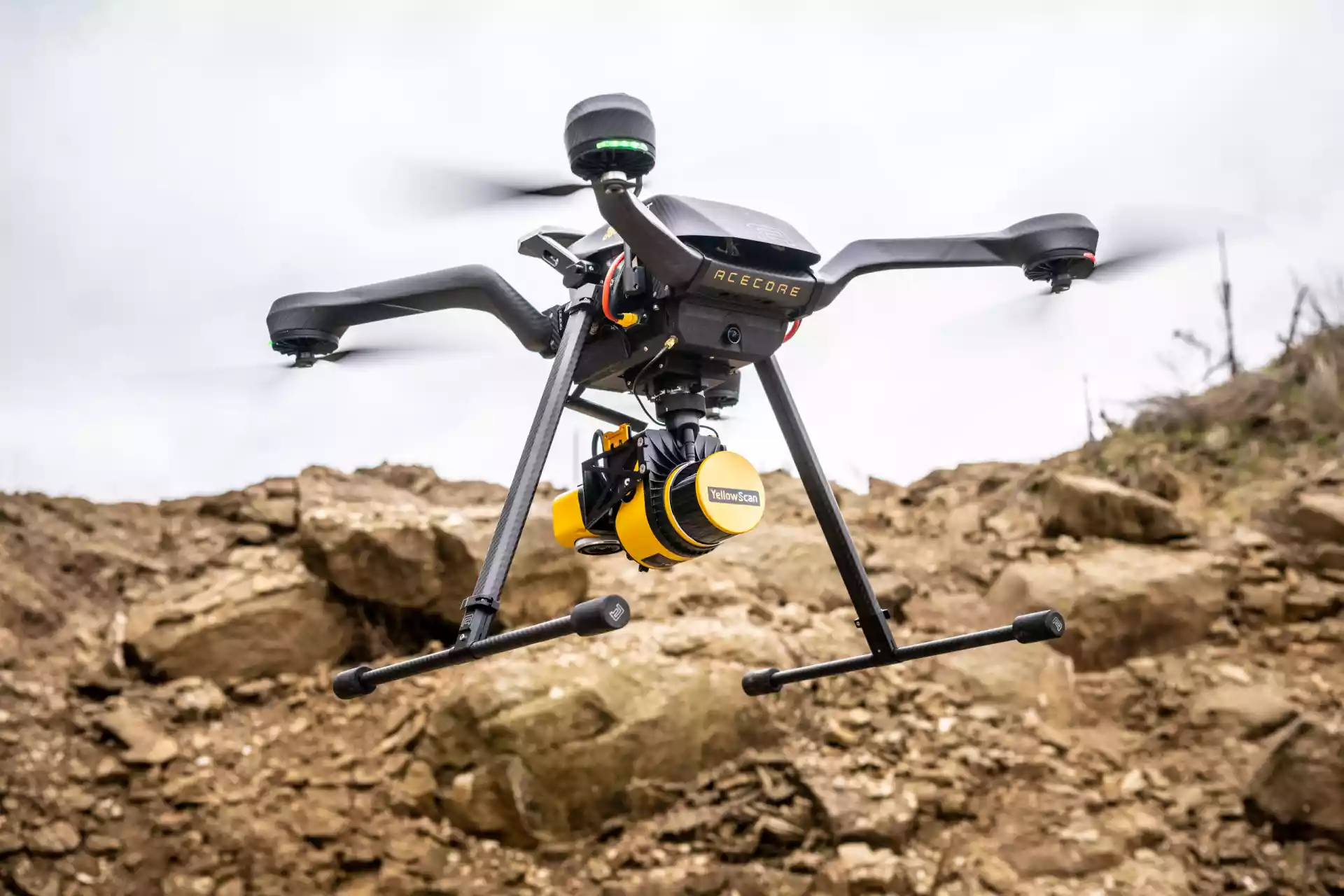
The family business has invested heavily in the new areas of responsibility. State-of-the-art laser scanners, LiDAR scanners, drone equipment with large copters and the hardware for evaluation are available to Reuschenbach and his team for surveying services. As is typical for Augel, individual services are also available in the GIS sector depending on the type of project and customer requirements. Neither expensive hardware and software for evaluating and processing the huge image files is needed on the customer side, nor specially trained specialist personnel for these tasks. If required, the images are broken down accordingly and delivered in the data formats and sizes favored by the customer, according to the company.
Die neuen Vermessungs- und GIS-Leistungen reichen von drohnenbasierter Photogrammmetrie über LiDAR-Scanning bis hin zu terrestrischem Laserscanning und eignen sich für Grundlagenvermessung, Bau- und Architektur sowie zur industriellen Inspektion/Wartung oder Restauration von Baudenkmälern. Die LiDAR-Technologie ermöglicht Aufnahmen in schwer zugänglichen, dicht bewachsenen und außerdem komplizierten Geländeformen. Aus den aufgenommenen Punktwolken können anschließend 3D-BIM-Modelle für eine durchgängige, digitale Baudokumentation erstellt werden – eine weitere Dienstleistung von Augel.
'The use of these modern surveying services offers a number of advantages over traditional methods. LiDAR technology in particular promises high-quality images, even in less than ideal weather conditions. There is usually no need to deploy additional survey teams. At a time when skilled labour is frequently in short supply and time is often scarce, this is an invaluable advantage', concludes Reuschenbach.
About Augel GmbH
Augel GmbH from Weibern in the district of Ahrweiler, Rhineland-Palatinate, is a third-generation family-run specialist for complete solutions in highly sensitive industrial and plant construction in the energy and petrochemical industries. As a pioneer in the digitalisation of processes and through the use of state-of-the-art technology, the company enables high cost security, predictability and worry-free processes throughout the entire project.